Table of Contents
A river delivers a given load of sand, and hence of heavy minerals, into the sea into which it empties. This load is fixed by drainage basin characteristics and processes. Wave energy available for redistributing that load is fixed in an entirely different way.
Estuarine Traps
Rivers which flow into estuaries, sounds, lagoons, or bays generally build deltas which are shaped by the water-bodies into which they flow, and which contain practically all of the mechanical load. Part of the clay and fine silt (among the finer sizes of the wash load) may remain in suspension long enough to pass from the more-or-less protected depositional site into the open sea, but this material is (at the moment) of relatively little economic-interest. The coarser wash load, and all of the bed load, are trapped near the river mouth. The location is known, and the total volume of the deposit can be determined fairly easily.
Furthermore, location, on a map, of an estuary or sound does not guarantee that a large volume of sediment will be found there. Some protected bodies of water of this kind are the sites of debouchement of non-alluvial rivers (i.e., no appreciable mechanical load). Other such sites are marked by the deltas of streams which drain uplands which do not supply, possibly for reasons of deep weathering or non-availability, any minerals of interest.
The Equilibrium Concept
Many important alluvial rivers flow either directly into the sea, or into a protected body of water across which a sub-aqueous delta is rapidly built, so that relatively strong river currents carry the bulk of the bed load into the sea. Under circumstances of this kind, the important fact to establish is whether the river, or the sea, is capable of moving the greater volume of sediments of the size being introduced into the area. This can be done qualitatively by a geologist, who examines the outline of the delta, and samples it for content.
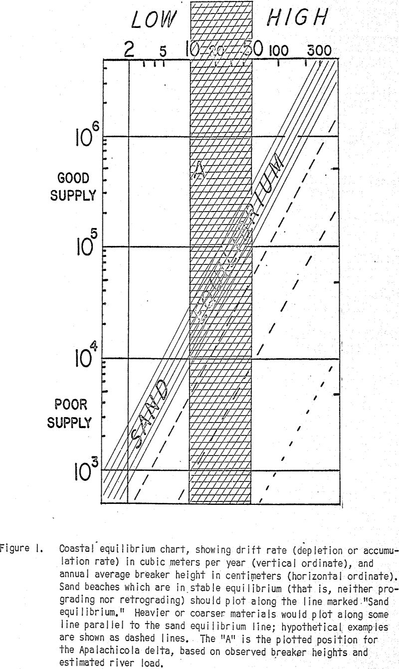
A semi-quantitative evaluation of coastal energy can be made by any of several available methods. The first step in this general procedure is to determine the dominate type of energy along the coast in question: wave, tide, or current. An inspection of the area should establish which is dominant. In most instances, tide-dominated coasts will be low-energy, or even zero-energy, coasts as far as breaker development is concerned.
The Apalachicola Delta
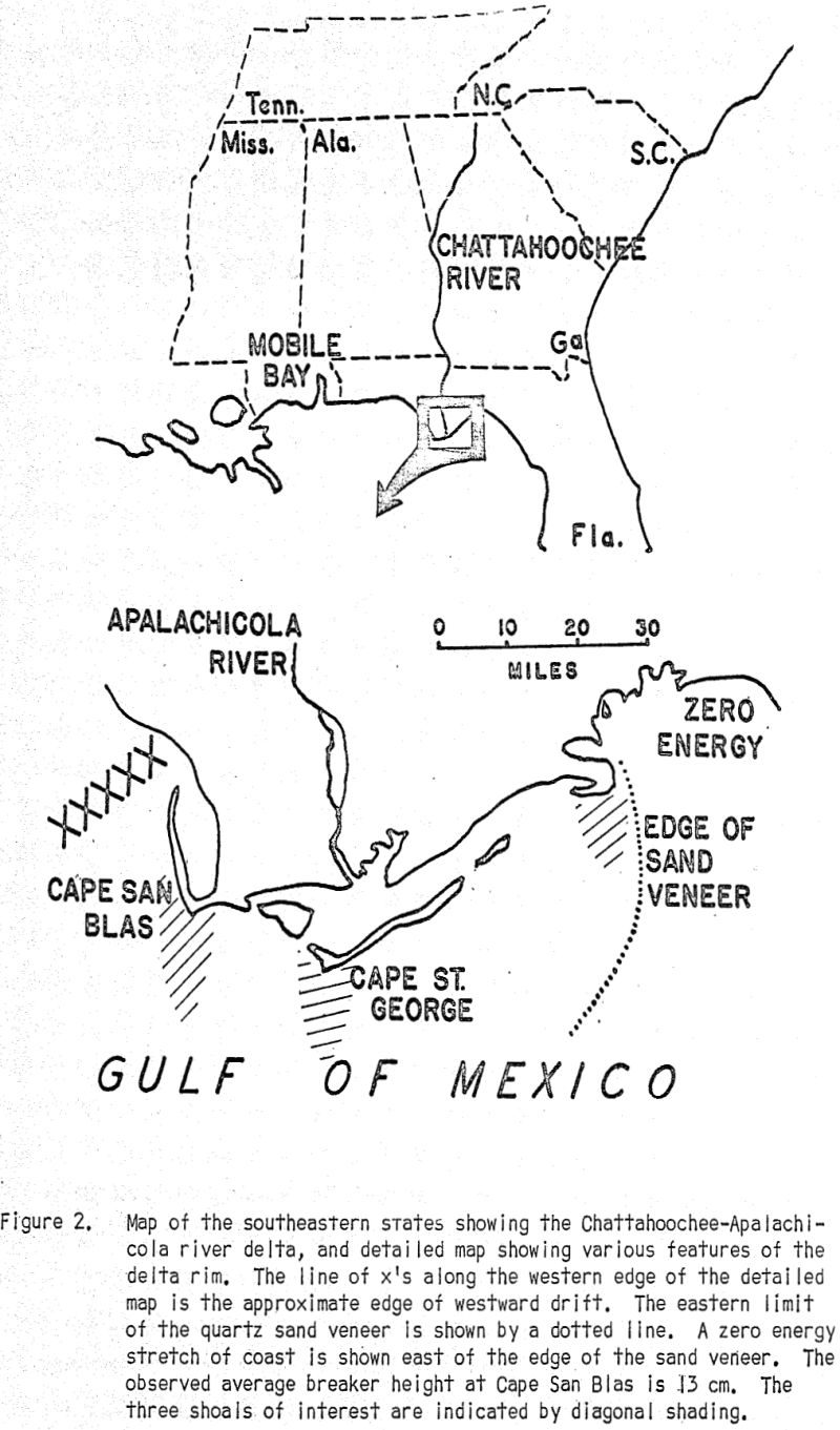
The coast in the vicinity of Keaton Beach, Fla., typically has NO breakers at all; that is, it is a true zero-energy coast (as far as wave energy is concerned). From these two values, it can be estimated that the annual average breaker height near Cape St. George is roughly 10 cm. The amount of drift material needed to maintain coastal equilibrium is — from the chart — about 2 x 10 4 m³ per year.
Heavy minerals can be expected to form what we might, call a “lag” deposit. That is, unless they are, grain for grain/much smaller than the associated quartz, they will not move as readily. Hence a trapping mechanism, such as we have at the mouth of the Apalachicola, which is almost 100% efficient, must be no less efficient in trapping heavy minerals. We conclude, therefore, that essentially all of the heavy minerals which the Chattahoochee-Apalachicola river system has transported from Georgia and Florida must have been deposited close to the rim of the delta.
It is, of course, possible that these shoals are not really attractive areas for exploitation; this decision will have to be made by the company which holds the lease. However, the concentration of heavy minerals on the shoals, whether commercial or not, is nevertheless real,.and therefore the area illustrates the operation of a hydrodynamic method of concentration. An understanding of the operation of the processes involved should permit the geologist to make profitable searches in other coastal areas.


