Table of Contents
Prospecting and exploration that is a search for precious metals deposits is not a simple process because big deposits were discovered a long time ago. There are several places with important content of precious metals waiting for skill prospectors. The large mining companies of the world are focused in big deposits and the small deposits are attractive for small miners and perhaps their interest for gold is the most valuable tool for exploring new deposits.
Gold is a very widely disseminated throughout nature and may be found in any geological formation from the oldest rocks to the deposits that are still being formed, but in common with other metals, it is more likely to be found in the oldest rocks and in those places where the earth crust has undergone the most extensive changes such as elevations, folding, tilting, faults, fissuring and also volcanic action, with resulting changes in the composition and texture of the rocks.
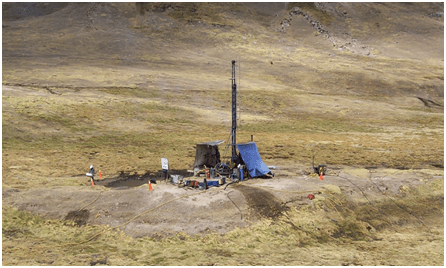
Samples can be obtained by drilling programs
The current technology is very important in development new project and exploration of new deposits begins with the selection of a target area. This is followed by reconnaissance exploration in which satellite remote sensing; geological mapping and seismic techniques are used. In turn, this is followed by detailed geophysical studies and later, a detailed drilling, sampling, assaying and mineralogical study. Gold deposits are sought with many techniques, but they are based on geochemical studies. Commonly more than one method is employed. With these methods, the geologist is looking for anomalies. Perhaps, the most important techniques are photogeology and seismic techniques.
Photogeology
Photogeology is a very important of gold deposit exploration. It gives complete information of high altitude photography and satellite photography. Images are recorded either on films or by recording the image digitally. Films used include black & white, true color, and Infra-red. In color photos, the red areas indicate live vegetation. This makes them useful for locating outcrops in highly vegetated areas. Also least affected by fog, and is effective in cloudy environment. It is also good for determining moisture content of soils. The typical aerial photos are those which are taken with the camera lens vertical due to oblique photos could exaggerate the relief.
In general, photogeology involves the interpretation of an area’s geology from analysis of landforms, drainage and vegetation. Basically, there are four types of information, fracture and trace analysis, fracture identification, seep detection and channel change study. When a fracture is observed in cross section, it seems to be vertical or near vertical breaks in the bedrock. Gold particles can be deposited into fractures. Other important information is the called lithological mapping, which involves the interpretation of surface features so that can be obtained a more exact map.
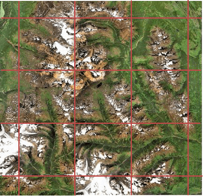
Identifying areas to be prospected
The map scale towards the center of the photo is different from the map scale toward the edges of the photo. Orthophotos are images which have the distortion rectified, and can be used directly for mapping purposes. There are many applications of photogeological methods in mineral exploration work as well as in the studies of environmental geology and geologic hazards. Most importantly, they are used to make accurate topographic base maps. In mineral exploration work, accurate topographic base maps are essential for recording geological observations. Rock and soil color changes, or color anomalies, can be delineated and possibly investigated with ground traverses.
Photogeologic analysis provides data on local geology conditions which help to detect possible gold zones. Even, it is possible to get information on ground water movement, and this is influenced by fracture traces, karst features and aquifer recharge and discharge points such as springs. It is possible to get information on lithology, alteration and structures. When the work was performed properly, there will be possible to know the structural features in a specific area, such as the direction and dip of the beds, fold direction, and fault plane dip. Color contrasts in exposed bedrock due to changes in rock type, or lithology, and can be traced on the photograph, to map out the contact. The information can be gathered more efficiently and safely than a ground traverse, although there is no substitute for direct observations.
Photographic surveys follow specified flight routes and take the photographs at regular spacing along the path. The overlap between adjoining photos in a sequence along the line is about 55-60 %. The overlapped area is detected by the camera from two different views in two different photos. The two adjoining photos used together make what are called a stereo pair. The two photos can be placed side by side and observed with a stereoscope.
Once the need for Photogeologic support is identified, the place is screened for suitability. A preliminary determination is made to insure that the site is located within the appropriate geologic terrene for the requested Photogeologic work. Government and private sources of overhead imagery are searched for available coverage and information on geology, hydrology and soils is compiled. Close contact with prospectors and gold companies assures that the results of the study will provide the information required. The results of the Photogeologic study are compiled into a bound report that includes figures, maps, and interpretation.
Seismic Method
Surface seismic techniques used in gold exploration are restricted to seismic refraction and seismic reflection methods. Probably, the first one is the most employed. The equipment employed for both techniques is very similar and assure the travel time of acoustic waves propagating through the subsurface. In the seismic refraction method, the travel time of waves refracted along an acoustic interface is measured. In the other technique, the travel time of a wave which reflects off an interface is measured.
The information to be obtained is dependent on the acoustic properties of the subsurface material. Specifically, their properties can identify various geological materials. In this way, the interpretation of seismic indicates changes in lithology or stratigraphy, geologic structures and water saturation zones. These techniques are commonly employed to know the depth and structure of geologic and hydrological areas.
The seismic refraction technique is a geophysical method widely used to explore the ground. Basically, seismic waves travel outward from a source and reach a detector. The detector first senses the waves that went directly to it along the ground surface, and then it senses waves that went downward, were refracted at a deep layer, then left the deep layer and came back to the surface. Due to the waves move faster in the deep layer, they take the surface waves. At a certain distance exists a crossover point, the refracted waves reach the detector first. With this initial information, a few assumptions can be considered about the place and we can know the thickness of the surface layers and its possible composition.
The information obtained can be used to make a map on bedrock topography, determine the depth of gravel or sand, delineate perched water tables, detect subsurface caverns, identify shallow faults and fracture zones, and detect large boulders.
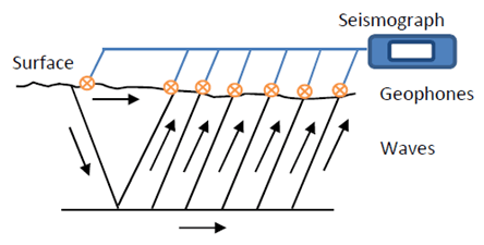
Seismograph received data on waves travelling through different rock types
Seismic refraction explorations are based on the time required for a seismic wave to travel from a source to a receiving point. Basically, a sound can be used for the seismic source and twelve or more vertical geophones are used for the receiving points. The selection of the seismic source depends on the seismic line, the resolution required, and the environmental properties. A signal enhancement seismograph records signals from the geophones. By analyzing the arrival time of the seismic wave as a function of distance from the seismic source, the seismic velocities of the underlying soil/rock units and the depth to geologic contacts can be determined. The geophone spacing and the distance between the seismic source and the first geophone are designed to obtain the needed penetration and resolution. The method is usually employed to areas where seismic velocity increases or is constant with depth.
The seismic data are studied by plotting the arrival time of the wave at each geophone versus the distance from the seismic source to the geophone. These charts are commonly known as travel-time plots. The data have to be fitted with straight-line segments. Each line segment corresponds to a different stratus or layer. The reciprocal of the slope of the line is the apparent wave velocity of the layer. Current state-of-the-art analyses use forward and inverse modeling and ray tracing that seek to minimize discrepancies between field measured arrival times and corresponding times traced through the velocity model.
The seismic velocity of a geologic stratus can be known by the refraction method and a relative estimate of the depth to different acoustic interfaces. Seismic refraction surveys are very useful to obtain information on depth at different locations. Refraction surveys are useful in buried valley areas to map the depth to bedrock thickness of overburden. The information obtained can be related to various physical properties of the bedrock; rock types have specific ranges of velocities. For example, dolomites and granites have different seismic velocities. A key aspect of this method is the line length to me measured. It is recommended that the distance from the seismic source to the geophone station or reception point have to be three or more times the desired depth of exploration.
Sample Extraction
It is essential in the evaluation of a gold deposit to have, as accurately as possible, a model of the mineralized zone geometry, shape, size, quality, variability, and limits. Physical, chemical and geological characteristics may vary greatly within a single deposit and from deposit to deposit. Critical data can be collected in a variety of ways, including drilling, surface and/or underground mapping, geophysical or geochemical surveys, or studies of rock mechanics properties, mineralogical types and relations.
- Sampling
The initial prospecting work is conducted on the potential place and consists in taking samples. The first samples are grab as single pieces and later can be composited if were necessary in nature, lacking any definite width characteristics, but useful in identifying local mineralization and possible geochemically anomalous zones. The rock sampling can be done by regular people, but ideally a geologist must oversee this task. It is important to determine sample station using handheld GPS devices, usually accurate to within 5-10 m. As was mentioned samples are initially grab in nature, but also, it is important to take chip samples across structures and veins in order to determine widths of mineralization and the presence of any wall rock mineralization near to these structures.
If the sampling program is detailed, the initial number of samples is more than 500 and this can be composited according to the first mineralogical assessment. For example, it is good practice to prepare at least 100 composites from grab samples in 1-4 m2 areas along 50 m and spaced lines at 10 m spaced sample locations. The samples can be assayed for several elements if there is not any economical restriction, otherwise the assays must include at least gold and silver. In this way we can know a preliminary distribution of metals. For example, of 100 samples collected the average gold value can be 2 g/t, with 40 samples reporting more than 1 g/t gold. Usually, the silver content is higher than gold content. If other metals were assayed, it is possible to establish a correlation between base metals and precious metals. In some places, local high sulphidation epithermal overprints within a predominantly polymetallic style hydrothermal system.
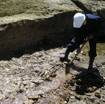
Taking samples by using a shovel
Other initial information to be obtained is the possible occurrence of anomalous to significant contents of precious metals in the different zones where grab samples were taken. If more information is required, part of the samples can be submitted for Whole Rock Analysis and X-Rays. It must be mentioned that samples usually vary from fresh to altered ores. The results to be obtained can confirm the existence of several populations among different rocks such as volcanic and andesite. Then, we can infer can some rock were formed or derived from the chemical reaction or weathering of other rocks. Essentially, it is possible to establish a preliminary paragenesis of the deposit.
Other points to be sampled are stream sediment. These samples have to be collected in different stations along each drainage and theirs positions can be determined by using a GPS. Results of the survey provide information on potential areas of anomalous base and precious metal values throughout the place. By performing statistical analysis is possible to know what zone or zones are more important and basically the gold and silver distribution.
Soils must not be overlooked. It is important to take collected samples over 2.0 km x 2.0 km areas. Samples can be taken at 40 m station along 150 m spaced grid lines, each line approximately 2 km in length. One more time, sample stations are located using a GPS device. Results of this survey let identify precious metals within the grid area.
- Trenching
Preliminary exploration can be performed by trenching. This method needs a backhoe or bulldozer, which makes possible to observe and take bulk samples on a continuous basis across the mineralized zone. Several ore types are weathered easily at the surface and these layers have to be removed in order to have good information on mineralogy and lithology. Preliminary trenching and pitting may be done with the objective of providing initial information to geologists in order to improve the parameters estimated for this sampling program.
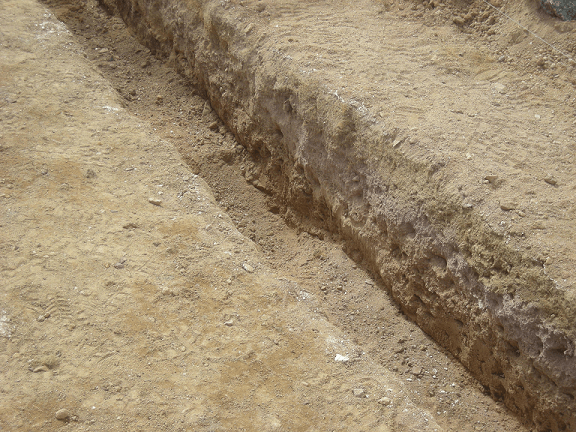
Different rock layers are detected by trenching
Normally, trenches are excavated by hand employing picks and shovels until the bedrock is visible, most the time at depths of 1 to 3 metres. Trench sampling can be carried out by channelling a sample along the floor of the trench. Each channel is between 10 to 20 cm wide and 5 to 10 cm depth. Samples are taken for geological purposes. In this way, veins, altered zones or different mineralized zones can be sampled so that the contacts can be 2-4 cm within the sample boundaries. Sample weights are usually between four to eight kilos.
In serious and big trenching programs, bulldozers are employed to explore the different areas at different depths. That kind of equipment is easily available when is necessary to move huge tonnes of waste material to access the place. Mechanical or hydraulic rippers are employed in difficult mineralized zones. If extra depth is required, a shallow shaft is sunk at lower cost and with less damage to the surface. The face or uphill side of the trench is a zone of geological information and sampling point due to these zones are virgin and clean of broken material. Trenching programs are useful when they are planned properly, but they could be a waste of money and time when the program was prepared without technical considerations.
- Drilling
If the grab sample gave interesting results, a drilling program must be planed in order to have a better knowledge on the deposit. The drilling program can involve one or more types of drilling, conditioned by the material to be sampled, rock environment, and the reason of the sampling. Basically, there are two types of drilling, one involves core drilling and the other one is reversed circulation.
The core drilling is employed for most the mining companies. The main disadvantages are the cost and the time required to complete the programs, however the information to be obtained is excellent. Essentially, provides accurate samples of a mineral deposit, the rock types, mineral types, and rock structures. By employing this method, the core is removed from the hole. There are some variations of this technique than improve the time required to extract the core. This greatly accelerates the drilling process and improves core recovery. However, it yields a smaller diameter core. Some drilling techniques often produce poor core recovery, but with improved core barrels, a good design, the total core recovery can be improved. Disadvantages of diamond core drilling are its high cost, small size of sample and slow penetration rate. Bulk sampling for metallurgical testing or placer deposit testing are generally obtained by the drilling of large diameter holes (plus 6-inches in diameter), or by sinking winzes.
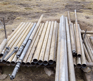
It necessary to get the right material according to hole to be drilled
During the drilling program the core has to be stored and extracted for geological and metallurgical purposes, which reduces cost and time. There are five main sizes of diamond core employed for mining projects,
| Type | Diameter
mm |
Cost
$US/m |
Geological
Studies |
Metallurgical
Studies |
| AQ | 27 | 90-130 | √ | √ |
| BQ | 36.5 | 100-150 | √ | √ |
| NQ | 47.6 | 120-180 | √ | √ |
| HQ | 63.5 | 140-200 | √ | √ |
| PQ | 85 | 180-350 | √ | √ |
The cost is influenced by rock type, terrain conditions, environmental conditions, and time required to complete the program. The time depends on ore body size, diamond core diameter required, geology department and the previous information obtained at the beginning of the project. For instance, if the objective is to have complete information on mineralization and perform metallurgical tests (e.g. comminution, concentration, leaching), the time required is around eight weeks. Obviously, there are several activities involved such as mobilisation of the drill team on site, drilling, geological mapping, core splitting, core logging, and core packing. Finally, the samples are delivered to different laboratories.
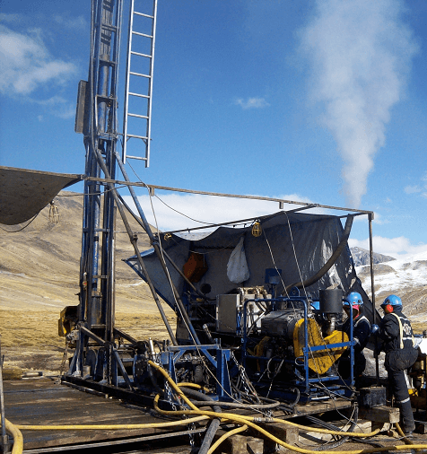
Performing a drilling program
Reversed circulation drilling is a fast and cheap method. Unfortunately, the samples obtained provide no much information on mineralogy and the metal content can be no very reliable. Since the sample are not very deeper, information and data have to analyzed and studied carefully. A hammer transmitting its force through drill rods to a rotating drill bit which does the penetration. Air or water is circulated through the drill rods to cool the bit and carry out the rock cuttings to the collar of the hole, where they are collected and prepared for study and assay. The method works well where the wall rock is competent, dry and impermeable. It has a practical depth limit of 45 to 90 m. Metal values may be lost by seepage into the wall rock, or added or diluted by caving or seepage into the drill hole. Reverse circulation of the drill water down the hole and up the drill rods greatly improves the accuracy of the sample. Sometime, mining companies during the first months of operation employ this method to study zones that were not studied well during the exploration program. Results are different. For example, by employing a core drilling program the average gold content was 5 g/t. however, the second method on the same place gave higher values, 10 g/t. This situation creates doubt and conflict between the design criteria and the new values. For this reason, results obtained by reversed circulation need a special study and interpretation.
There is other option called Rotary drilling. This technique is inexpensive and fast and similarly to the reverse circulation drilling, there is some disadvantages such as samples are broken into small chips that don’t show the structure of the bedrock and the samples submitted for assaying are not very realistic. Most of the rigs are truck mounted and completely self contained, including the air compressor. Standard tri-cone bit can drill a hole four inches in diameter and the drill cuttings are blown out of the hole with compressor air. Samples are piled on the ground in rows, each pile represents approximately 0.50 to 3.0 meters of advance and each row from 6.0 to 30.0 meters of hole. Ideally, the sample must be collect in appropriate containers. This method is preferred by people who want to perform the sampling and logging in the same drilling hole.
Sometime, the drilling can be performed in two parts if the first program didn’t cover all the mineralized area. This additional drilling program can be complemented with geophysical methods in order to define the objectives of the program. For example, magnetic surveys identify magnetic zones that are related to silica cap areas. If the deposit presents high sulphidisation in areas far from the main ore body, the extra drilling is recommended. This can occur in deposits with structural and stratigraphic control and consequently some areas could be occulted. If the mineralization is close to the surface, at deeper areas may be or not possible to find high mineralization.
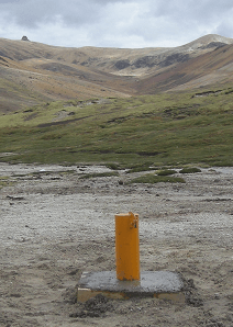
It is important to mark all drilled points
The drilling procedure can be designed under several considerations such as the geology team set out the holes in an area close to the drill rigs, drilling pads are done with bulldozers and the geologist oversee the work, cores are laid out for inspection, the final hole depth is decided by the geologists, hole location is recorded by GPS system, and geologist performs logging and coordinate the sample storage. There are other considerations that depend on the drilling target.
Sample Handling
There are two types of samples to be studied. The first group is formed by the grab samples taken at the beginning of the project. These samples are basically rock chips. These samples must be bagged and sent to the lab for assays and metallurgical tests. The second group is constituted by cores from drill holes, cut channel samples or bulk samples from trenches, or underground workings. Similarly to the first group, the samples need to be assayed and tested metallurgically. For assays, these samples must be reduced in volume and size of particles without dilution or enrichment of metal values.
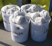
Samples must have specific codes
Field samples are sent to the sample preparation facility where the samples will be divided for geology and metallurgical information. In order to deliver the sample in the best condition to the laboratory facility is necessary to consider some factors such as use appropriate labels and names to identify the samples, define the procedure to be employed for bagging and sample collection, assure the sample preservation, manipulate the sample when is necessary, and minimize the movement of the sample in and out of the container. The storage and transportation must consider the oxidation conditions to be exposed the samples and more even if the presence of sulphides is important. Under this consideration, samples must be stored in a freezer. If the samples need to be logged and cut, they must be taken from the freezer. When the samples have to travel a long distance is good practice to wrap the samples in a bag which air was purged with nitrogen. In this way the sample will stay in inert atmosphere and the possible risk of oxidation will be minimized.
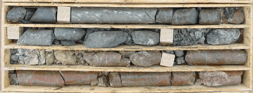
Cores must be stored and transported in boxes
Normally, drill core samples are split in half with a diamond core saw. One half is submitted for analysis and/ore metallurgical tests and the other half is stored. The core has to be photographed at the site, geologically logged and geotechnically logged. The core samples are selected by the geologist based on logging information and must be labelled with the right code and name. Samples range in length from 0.20 m to 2.5 m and their weight is variable, 1.5 to 6.0 kilos. The half core samples are bagged and placed in sacks, security sealed and shipped to the laboratory for sample preparation according to the testwork program.
Assays
When the samples arrive to the laboratory for assays, they are codified according to the laboratory system and weighed. Each core sample is entirely crushed to almost 100% passing 1.7 mm (10 mesh). Samples are homogenized and one kilo is split and pulverized to approximately 90% passing 0.075 mm (200 mesh). Then, 200 to 300 grams are split. If the samples are wet, it will necessary to dry the samples without using any heating system in order to avoid any physiochemical change in the samples.
In order to control the sample preparation procedure, approximately 5 to 10% of the crushed and pulverized samples are submitted for a regular particle size analysis by using lab screens. Blank samples are included into this control so that the sample preparation procedure can be done properly. These samples can be added into the core samples at a frequency of 1 in 30.
In order to perform assays for gold and silver, 40-60 grams aliquots are taken for fire assay. This assay method employs fluxes according to the minerals present in the sample due to the fluxes are variable and there is not a unique recipe. Some assays for other elements are performed by atomic absorption. For example, we can have 1,000 to 50,000 samples to be submitted for 20-30 elements. Sometimes, assays for almost all the elements can be done by Inductively Coupled Plasma (ICP). Gold is always assayed by fire assay using 25-35 g charges.
Certificated laboratories have a quality control procedure that includes the sample to be assayed, standard, blanks and duplicate samples into every assay. For example this procedure can consider three standards, two blanks and three repeats in every batch of 80 samples. If any discrepancy is found, the whole batch has to be re-assayed.
Prospecting
Prospecting is to search valuable mineral deposits and is the focus of many people around the world. Gold prospecting is a very special case due to is suitable for many speculations and potential objectives. Gold deposits are variable and the prospector needs few tools in order to detect potential mines. The modern equipment enables people to transform an obligatory task into a challenge. There is a question very important, where to look for gold? Try to answer this question is not simple, but there some clues to be considered.
Since gold is widely disseminated in the nature, it can be found in any geological formation, from the oldest rocks to the deposits that are still in formation. However, gold can be found in old regions and places where the earth surface has experienced many changes such as elevations, folding, tilting, faults and volcanic action, with resulting modifications and alterations in metal composition and crystalline structures.
- Sequence
Geological exploration is developed by steps, starting with studies in small scale and finishing with studies in big scale. In this way, the prospector has to analyze progressively the territories with important potential or perspectives to find the desired metal. This consideration obliges to evaluate different places with variable interest until find the right place so that it can be evaluated and verified as economical resource. Obviously, each step needs more detailed studies. Basically, there are four prospecting steps: regional, identification, local, and detailed exploration.
Regional exploration considers a region determined by geological, economical and accessibility factors. The limits of this sped are not necessarily associated to geological elements. Few times are carried out geochemical studies due to the main source of information are cosmic images, photogeological information and aerophysical data. The main objective is to define one or several districts within the region under study. The difference between district and region is arbitrary under special considerations. However, a district can be considered a discrete unit due to the identification and limits are conditioned by a special mineralization or geological considerations favorable to find any special mineralization.
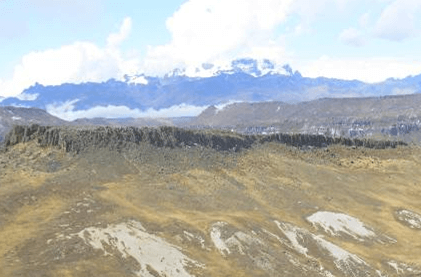
Anomalies must be sampled
It is necessary to perform studies on active sediments present in fluvial points. Typically, one sample per five square meters can be studied. In this way, the district will be defined. The geochemical study of rocks oriented to identify mineralized and sterile zones is appropriate.
Prospecting is the first exploration oriented to study a specific district, which was defined previously. The objective is to detect potential areas and not necessarily to find a mineralized place. The areas detected will be studied in detail according to the first results. This study is designed to define anomalies in a specific district or region. In order to do this is necessary to know the work scale that allows identifying the areas with major potential.
The sampling procedure must assure a detailed geological interpretation of the place, even to get information on the location of the geological contacts. In areas where there are prominent outcrops, the samples can be taken in areas of two square kilometers. The number of elements to be studied can be selected considering the previous study (regional study).
Local exploration tries to detect geochemical answers in small areas. The objective must be selected con precision and its location has to be very exact. Although the objective is not to locate a deposit, the development of the study could identify one. Basically, the objective is to define the mineralogy associated to anomalies of specific elements or group of elements. The sampling procedure and the expected answer are related to the type of mineralization required in the study. For example, sulphide deposits produce anomalous aureoles of hundreds of meters, and narrow veins are associated to anomalies developed in dozens of meters around them.
A detailed sampling of sediments at 20-200 m intervals is useful to define the location of any anomalous object. If the drainage system is poor, rocks can be studied only if the mineralization produces an extensive dispersion system. The number of samples is based on the drainage system and could be expensive.
Once the objective was defined, the next step is to locate the mineralized zone and its extension. Normally, studies of rocks and soils are the geochemical techniques more employed during a detailed exploration. It is common to take samples 150-400 m extensions with 30-90 m intervals. When the mineralized zone was located, samples will be taken with much more detail such 40-90 m with 5-10 m intervals in order to create a map with all the mineralization. The only way to identify the mineralization and all the changes into the zone is to perform a drilling program. Sometimes, trenching is an option. When the object was identified, the exploration process continues if the previous results were acceptable.
- Lithology
This term makes reference to the character of a rock described in terms of its structure, color, mineralization, grain size, and arrangement of its components. These parameters give a special characterization to the rocks contained into the deposit. For example is the prospection team identified a hydrothermal ore body, basically all the drill cores and outcrops around the deposit must have specific properties to this type of deposit.
Gold deposits can be located within breccias defined by multiple phases of breccias and associated to air fall pyroclastics. In this case, they could be divided in a sequence of bedded lithic, crystal and anomalous tuffs that overlie a massive basement. Basically, the host rocks are a sequence of lithic formations with fragmental texture and rapid changes during its formation. Then the prospector must be able to detect and/or identify these characteristics with information proportioned by the geologist. In this way, these lithic zones define a stratigraphy which special orientation. For example, they could deep between 5º to 15º towards the northeast, steeping and thickening proximal to the contact with the breccias.
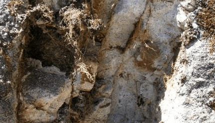
Fractures show vein orientation
The rock formation can stay beneath the lithic sequence and the contact could be unconformable. Then, it can be considered a modified mineralized zone with appreciable change into its structure. Sometimes, some rock formations formed a pre-existing land surface upon which the new formation was deposited. Probably, this kind of surface is related to breccia formation. A breccia formation is identified in the drilling program and/or trenching sampling program and the rock formation may to be in a large bowl shaped depression and could be constituted by two or more phases that form a new body. For example, if there are two phases, the first one is an early formation with consistent assemblages characterized by fine grained rocks. And the second one could have rounded particles with empty spaces formed during the cooling process. A typical example of the second phase is the presence of vughy silica.
All this information must be recorded during the core logging; otherwise the geologist will have to spend more time than necessary identifying the rock formation.
- Structure
It is important to identify the structure because the mineralized zone has a special orientation. Sometimes is difficult to recognize the right orientation, but the initial emplacement is the first reference point due to control the alteration and mineralization. The structures are characterized specific alterations, presence of stockworks with variable content of sulphides and brecciation. For example, some structures can be 1-3 m in width, but zones can be 30-50 m wide. This variation is an indication on the mineralogy into the deposits. For this reason, during the blasting sometimes is difficult to take a decision about the points to be drilled. This behavior is explained by the presence of hydrothermal fluids with subsequent mineralization.
There are some stockworks formed in areas very close to the mineralized zone or under special circumstances formed only in specific places. For example, some siliceous zones with important content of vughy silica can be detected in areas no very close to the main structure, which can be characterized by the presence of fractured stockworks. Certainly, this zone probably is influenced by combination of structures and breccias with different orientation. However, the mineralization is useful to detect these changes into the structures.
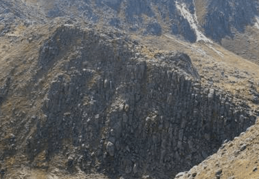
Fractures
When are detected several fractures is important to try to determine how were formed because we can know the possible final orientation of the mineralized structures. Normally, the combination of these structures can provide the host rock into the ore body.
- Alteration
This parameter can be considered as a physical and/or chemical variation in a rock or mineral during its formation. These changes have influence in the type of mineralization to be found into any structure. it is important to mention that alteration or changes and mineralization and processes developed in different periods. For example, an acid fluid leaches a rock producing a rock with many holes or empty spaces (vughy silica) and around this formation can be developed alunite and kaolinite zone.
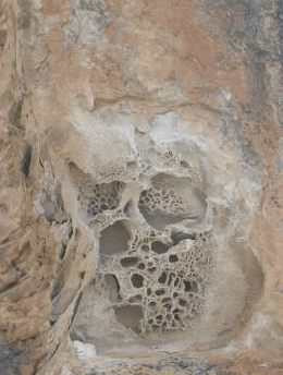
Indication of Vughy Silica Formation
According to the structure sequence and location is necessary different amounts of acid leaching agent to aggressively dissolve the rocks and the acid fluid formation are formed in water saturated places close to the structures. This creates zones with alterations into stratigraphic horizons. These zones can be characterized by containing variable amounts of different rock types whose alteration or leachability is different according to the stratigraphic horizons. In this way is expected to find zones of different level of porosity and permeability. For this reason, there are different types of vughy silica.
It is important to establish a relationship between altered zones and stratigraphic zones due to its formation and deposition is influenced by the leaching conditions. This is totally valid for gold deposit formation and especially when there are free gold particles deposited into the empty spaces of some minerals.
- Mineralization
Alteration has influence on gold mineralization. For example, intense leaching creates pathways or routes for metal bearing fluids and some spaces or positions are created to host gold and heavy metal sulphides. For this reason, some underground operation can produce copper and lead concentrates with variable contents of gold. Obviously, is expected to find some undesirable elements.
Ore bodies present mineralization at different depths and they are characterized by variable contents of gold. Probably, some zones have higher content than the others and they were influenced by the leaching fluids and the type of mineralized structures. For example, some intersections the mineralization is disseminated and distributed by stratus.
Hydrothermal fluids run along different rock formation and produce dipping mineralization that can be detected a variable distance from the main structures. Probably, important gold contents can be detected in some structures due to some lithologies were leached with more intensity than others. This can be explained by the stratigraphy and gold content near to the surface. Then, metal content in sulphide areas are related to the degree of alteration and structure formation.
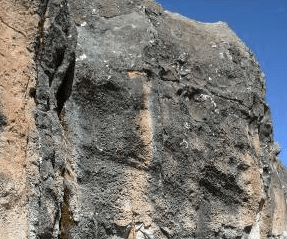
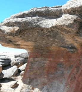
Mineralized Structures Mineralization and Oxidation
Where to look for gold ores
The geologist or prospector must have a knowledge on the ore types are most likely to carry gold; otherwise the time employed will be unfruitful. In most deposits is possible to identify the rock; volcanic, sedimentary, metamorphic, or even the river streams that transport gold. The valuable gold ores are brought in by different system of transportation such as percolating waters and gasses from cooling systems. The first one is probably the most important because they are charged with different heavy metals or base metals. The second one is other important source of gold ores and is characterized by special fluids locked into the rock in chemical combination. These fluids are extremely important in the formation of valuable ore bodies. They pass through different rock formations on their way to the surface dissolving several minerals and carry them in solution for large or short distances. These mineral loaded waters reach a space in the rock where they deposit their valuable charge. These spaces are open and formed by earth movements or large open spaces formed by dissolution of other minerals. In open fissures, vein deposits can be identified. Fluids may leave their metallic minerals into porous formation like granite to form disseminated deposits.
Gold is not very soluble and high pressures and under the presence of some chemical agents is possible to be transported in solution. Percolating fluids are mainly acid ground waters that penetrates rocks, dissolved the matrix and transport metals to different parts. These metals could be lead or copper. For these reason some polymetallic deposits contains important amounts of gold.
When we have to talk about gold mining, everybody thinks on free gold. This idea started at the first days of gold deposit processing. The gold from original veins was gradually disintegrated through the time. Gold being heavy and resistant to weathering has been concentrated in sand, gravel and different rock formations. Probably placer deposits have been mined for most miners since the first days on mining.
Placer deposits have been formed by the mechanical concentration of heavy minerals and the product to be extracted are of very important commercial value. This means the marketability is totally successful. Basically, the minerals to be present in marketable products include all the material characterized by high specific gravity and resistance to wear and weathering. Precious metals belong to this group and may be possible to find other heavy material such as magnetite, chromite, rutile, monazite, zircon or gem stones. The big alluvial placers have been formed after a long time. Placers deposits are easy to prospect and estimated in qualitative form. A gold pan is the first tool to be employed at the moment of find out the values minerals present in the deposit. The heavy concentrate collected is examined with great detail. For example, if magnetite is present, a magnet can removed this material and the remaining product can be examined by using a magnifier glass and reactivity to some chemical reagents. Even is good idea to evaluate radioactivity. If the results are positive, the material can be sent to a special laboratory in order to confirm and get more information on the material.
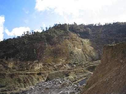
Placers are found in the jungle
Placers are located in or adjacent to a river stream. The material has been formed by the action of running water, ocean, lake waves or winds. For many years, aquatic deposits have been mined, and most people overlooked deserts places. The main obstacle has been the lack of water at these places, but the technology has developed dry concentrators capable of recovering gold. These methods are the best alternative. The main examples of this type of deposits are located in Nevada and some areas of Australia. For some time, quicksilver was used, but results were not satisfactory and some operative problems were experimented by the amalgamation equipment.
In general, important values of precious metals may be found in any place, but they must be of practical level and quantity. Some small pieces may contain important values of gold, but the project must evaluate of the deposit. Normally, these cases are good for recreational activities or very small mining operations. In this way, the particle size and amount of material to be handled have an effect on the project. Sluices and rockers are good options for small miners.
Gold deposits may be located on the side of a mountain or on any bench removed from any body of water. These are ancient water deposits left by the flowing stream or probably the beach of a very old aquatic formation. Many times, formations are not accessible and the geologist or field prospector must remove material such as plants, rocks or ground. Some zones may report high gold contents, but the mineralogy is not always the same and the deposits could be extremely small. For this reason the metallurgical evaluation is complement with the deposit volume, otherwise, the project could not have the level of profit expected considering the first results.
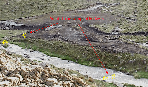
Bends and potholes are potential gold concentration points
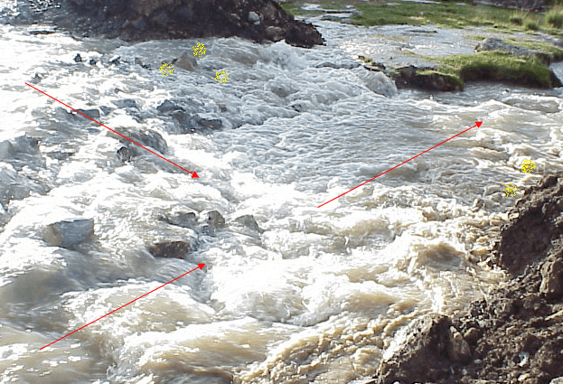
Where two rivers join must be prospected
It is well known that mountains and volcanic areas are more favorable for metallic deposits due to these places are characterized by faults and fractures in the rock formations that are appropriate for gold minerals concentration. In hilly or mountainous areas are favorable for the contact or outcrops, which indicate that values are under the surface. These are places where the vein could be exposed on the surface due to the action of different agents such as fluids or weathering. The first indications are mineral fragments or some material loose that look like a floating material. The last indication means that the ore source could be found in a slope.
Similarly to the placers, some outcrops can be covered by other undesirable material which has to be removed. Then, the prospector must be able to clean the area and follow the vein so that he can recognize the deposit orientation and possible volume. In general, outcrops are different in size and appearance. Some of them are characterized by silica rocks and standing notoriously on the surface. Other outcrops cannot be detected easily and apparently are small; however, many times they are big. It is well know that silica in limestone develops an obvious outcrop due to silica is more resistant to weathering conditions. In this way, many base metals and its mineral are weather easily and can be detected in outcrops. This is important to mention due to base metal minerals are potential gold carriers.
Outcrops may stay in an oxidation zone and the mineralization at deeper points could be totally different. Basically, the oxidation zone is influenced by the terrain, climate and geographical location. There may also be considerable enrichment in the oxidation areas, derived from the surface values. As the surfaces are weathered, eroded, leached and percolated by fluids, the valuable minerals are transported and deposited downstream. These processes proceed down to the groundwater level where oxidation disappears and sulphides appear.
Dry places are potential places where gold must be prospected. Normally these areas are dry, but in any moment a fluvial precipitation happen and the ground is eroded. A gold prospector must observe the zone and look for dry rivers.
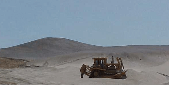
Waste material must be removed to access the gold zone
